
China Siwei’s newest commercial imaging satellites SuperView Neo-1 01 and 02 were successfully launched into space Apr. 29 aboard a Long March rocket. They upgrade China Siwei’s existing 50 cm resolution satellites SuperView-1 constellation, and provide 30 cm imagery to customers who are eager for more channels of very high-resolution imagery.
China Siwei is developing a SuperView Neo commercial satellite system, which includes at least 28 satellites dividing into 3 series. SuperView Neo-1 aim to provide 20 to 30 cm optical images. SuperView Neo-2 service customers for SAR images with 50 cm resolution in spotlight mode. First two 50 cm SAR satellites will be launched within the next few months. SuperView Neo-3 can acquire large swath-width optical image with resolution better than 1 meter.
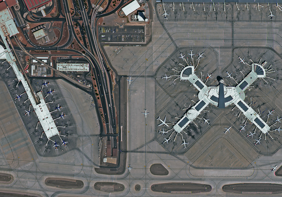
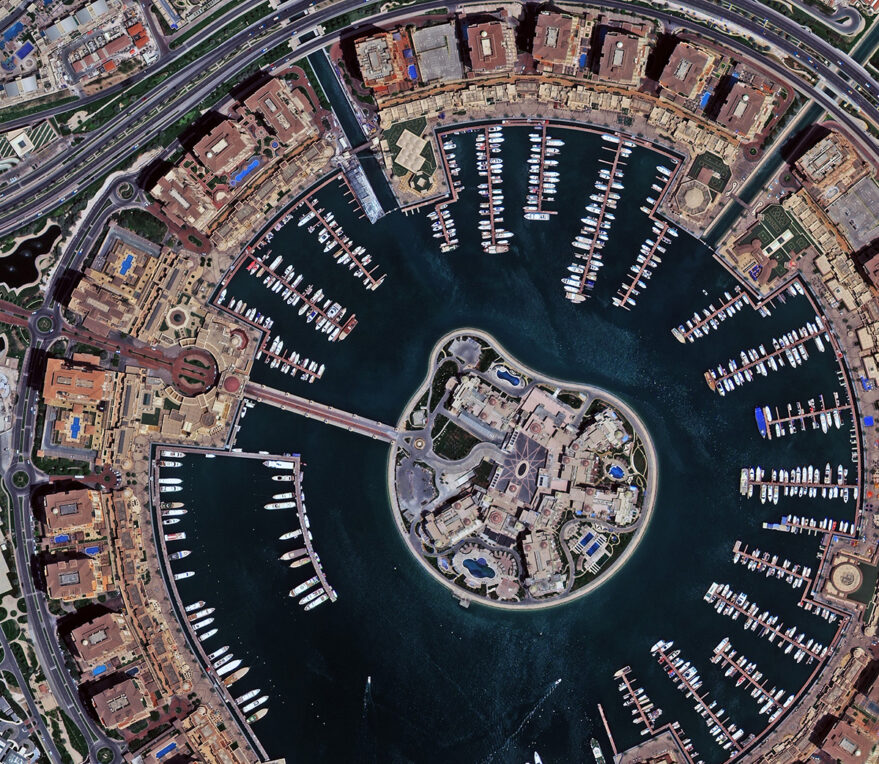
The images taken May. 3 showcase SuperView Neo-1’s imaging capabilities with pictures of McCarran International Airport in Las Vegas of USA and Qatar’s capital Doha. With 30 cm resolution customers can obtain greater detail for imagery analysis, and more ground information for intelligent mapping.
SuperView Neo-1 would add the company’s collection capacity to another 1.5 million square kilometers per day, and lift revisit capacity to 2 times per day with high agility. They will provide massive data and timeliness service for defence security, civil mapping, agriculture management, energy and transportation infrastructure, disaster monitoring and so on.
China Siwei is an earth observation satellite operator with nearly 30 years experience. As China’s largest satellite imagery provider, China Siwei provides end-users with the most comprehensive suite of satellite imagery products.
China Siwei will begin to deliver 30 cm imagery products in next months. China Siwei intends to cooperate with global partners in distributing imagery and intelligence application. For more information, please contact with customerservice@chinasiwei.com.