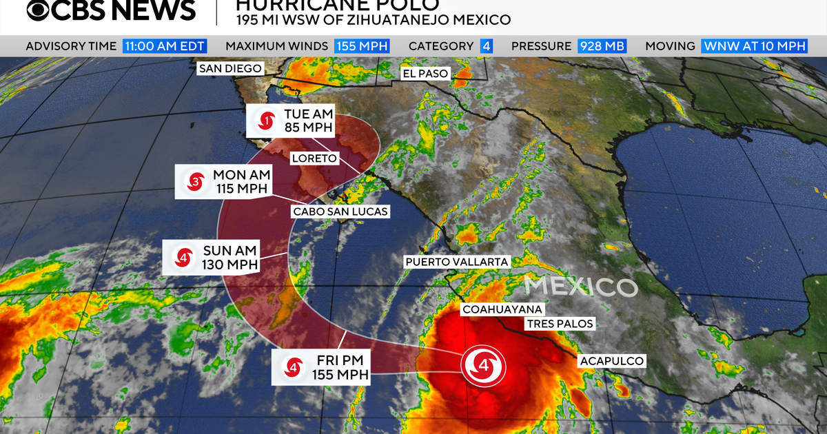
Forecasters say Hurricane Polo could bring “life-threatening winds and flash floods” to parts of Mexico’s Baja California Sur and nearby Sonora on Monday and Tuesday, with conditions starting to deteriorate Monday morning in Baja California Sur.
The U.S. National Hurricane Center says Polo will make landfall Monday evening over Mexico’s Baja California Sur and still be at or near major hurricane strength when it does, meaning it would have maximum sustained winds of at least 111 mph.
Hurricanes are classified as major when they’re at least a Category 3 on the hurricane scale.
“Polo is expected to approach the west coast of Baja California Sur on Monday, move across the peninsula Monday evening and then approach northwestern mainland Mexico late Monday night into early Tuesday morning,” the Miami-based center said.
“Polo is forecast to be at or near major hurricane strength when it reaches Baja California Sur on Monday, and it is expected to be a hurricane when it makes landfall in mainland Mexico late Monday night or early Tuesday morning,” the center continued. Hurricanes have top winds of at least 74 mph.
The storm’s intensity has fluctuated as it swirls off Mexico’s Pacific coast.
A hurricane warning is in effect for part of Baja California Sur and Mexico’s maindland from Bahia Kino to Huatabampito, and a hurricane watch is in effect for other parts of Baja California Sur and mainland Mexico south of Huatabampito to Topolobampo.
The storm had maximum sustained winds of 120 mph when the hurricane center issued its latest update very late on Sunday, Baja Califlrnia Sur time. Hurricane-force winds were extending outward up to 45 mph from the center of the storm, while tropical storm-force winds extended outward up to 105 mph.
Elsewhere in the Pacific, Hurricane Nolo moved past Hawaii’s Big Island this weekend, bringing heavy rain and winds.
Maps show Hurricane Polo’s projected path
Polo’s core on Sunday was about 260 miles west of Cabo San Lucas at the tip of the Baja California peninsula. It was heading north at 10 mph.
The storm is expected to move northward over the next few hours. By Monday, Polo is forecast to turn northeast and make landfall in Baja California Sur and then move across northwestern mainland Mexico by Tuesday.
CBS News/Nikki Nolan 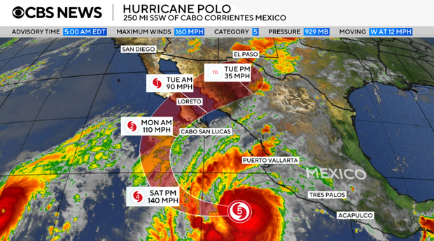
Polo could produce 4 to 8 inches of rain, and up to 10 inches in isolated areas across parts of Baja California Sur, the hurricane center said, cautioning that the rain “may produce life-threatening flooding and mudslides, especially in areas of steep terrain.”
CBS News/Nikki Nolan 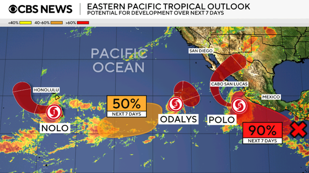
Mexican leaders ordered evacuations, opened shelters and deployed military troops to areas that could be affected by the storm.
Classes were suspended at schools across the city of Acapulco, along the coast of Guerrero, its municipal government announced. Shelters across the state remained open, and officials said they were coordinating with local and national authorities to prepare for additional impacts of the hurricane.
Polo’s extreme rapid intensification
Polo underwent what’s called extreme rapid intensification, in which a storm’s wind speeds increase by 58 mph or more over the course of 24 hours, between Sept. 21 and Sept. 22.
Its intensification was dramatic even by those standards, with winds that skyrocketed from 45 mph on the morning of Sept. 21 to 150 mph at around the same time the following day. The hurricane center described the storm’s transformation as “truly remarkable.”
Its maximum sustained winds climbed as high as 180 mph at one point, far exceeding the 157 mph threshold for Category 5, the strongest on the hurricane scale.
Polo’s central pressure — an indicator of its strength and potential destructiveness — made it the second-strongest hurricane on record in the Eastern Pacific, behind 2015’s Hurricane Patricia. The storm’s wind speeds tied 2009’s Hurricane Rick as the third-strongest on record for the region.
Unusually strong El Niño conditions this year have been amping up tropical cyclone activity in the Pacific, with warmer waters, moist air and less wind shear enabling storm formation.
Read the original article here